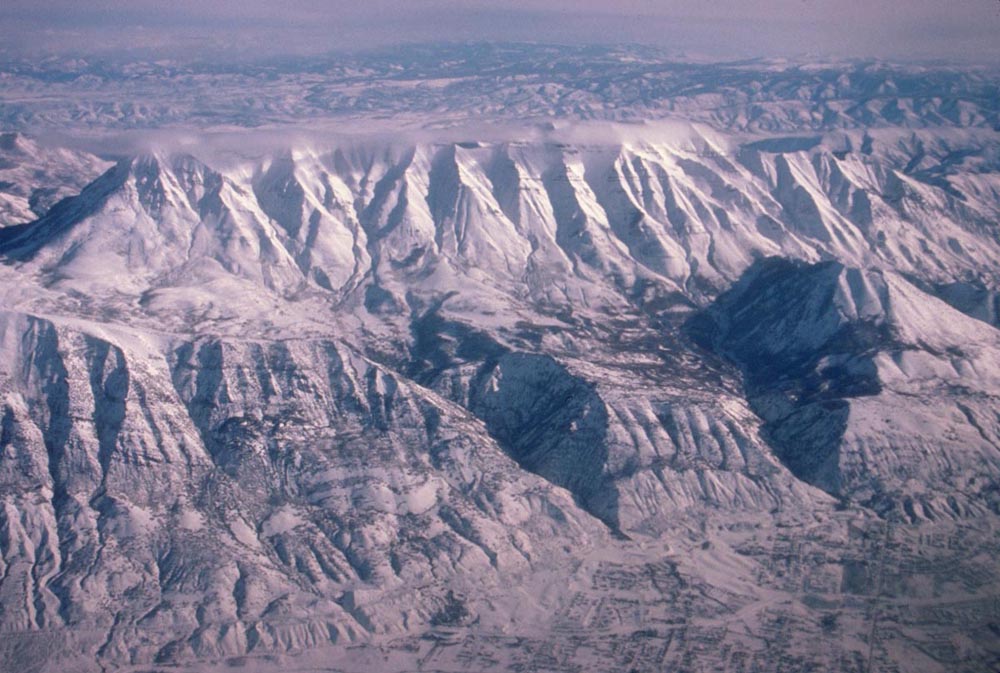
Mt. Timpanogos is the second highest peak of the Wasatch Range, at an elevation of 11749'. The Wasatch Range rises along the Wasatch fault, which is an active fault, and so poses a significant earthquake hazard to the Salt Lake City region. As evidence of recent faulting, two wineglass canyons can be seen behind the fault on the right side of the photo.
|
On to the first slide in this series: western edge of the Basin and Range: Owens Valley and Sierra Nevada .
Back to Cedar City, Utah and eastern edge of the Basin and Range.
Back to Aerial photos of the Basin and Range.
to Geology Images
Geology Photos Homepage