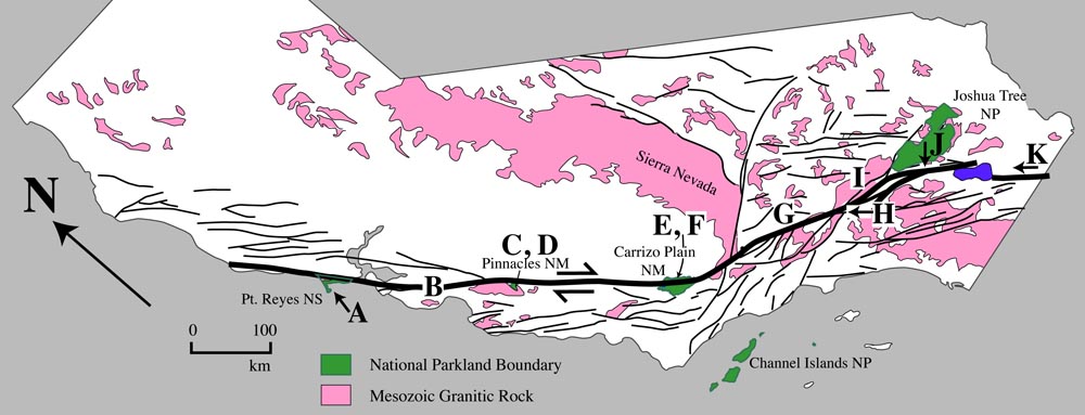
C. View over San Andreas fault zone to Pinnacles National Monument.
|
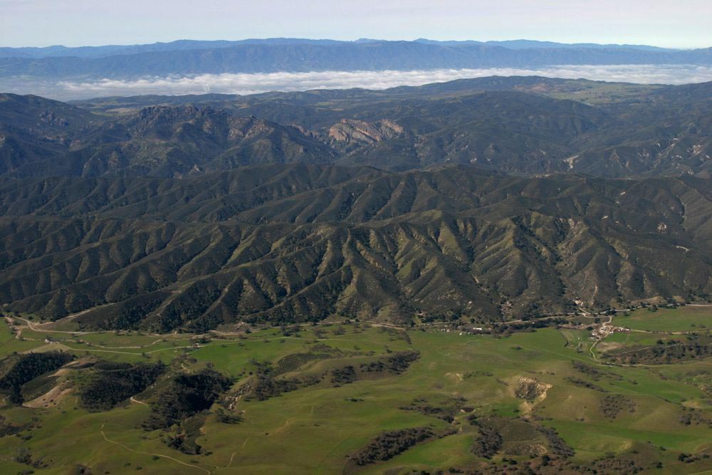 |
Photo C. View southwestward over San Andreas fault to Pinnacles National Monument. The fault runs along the base of the hills in the middle ground. Pinnacles consist of 23.5 Ma felsic and intermediate volcanic rock; it is visible as the north tilted layers near the center of the photo. Similar rock is found in only one other place on the other side of the fault: 315 km to the south in the "Neenach Volcanic field".
Back to San Andreas fault photos
Back to Geology Images
Back to home page