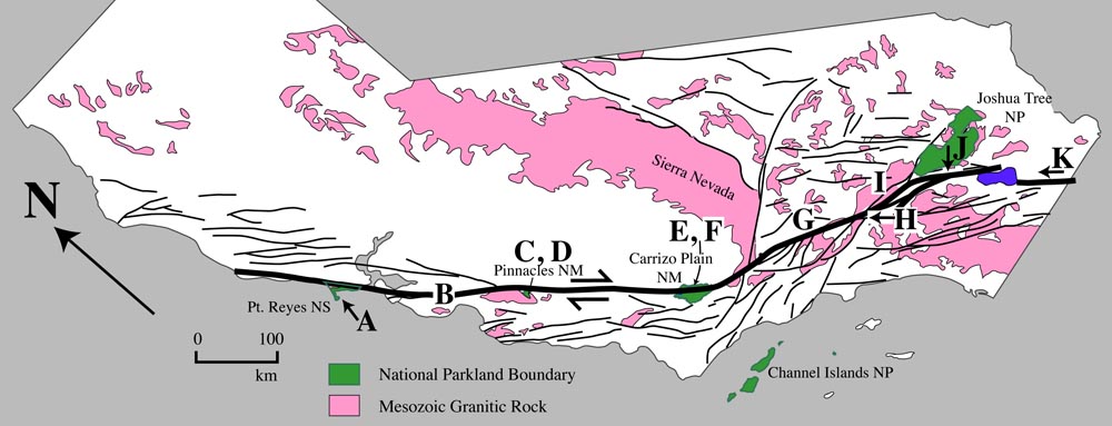
A. San Andreas fault zone and Pt. Reyes Peninsula
|
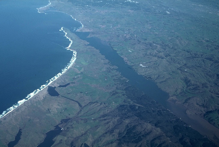 |
Photo A. Aerial view over Pt. Reyes National Searshore to San Andreas fault. The fault trace follows Tomales Bay, the narrow bay that trends diagonally across the photo.
Back to San Andreas fault photos
Back to Geology Images
Back to home page