Crater Lake Caldera
A lake at the top of a mountain... a deep lake at the top of a mountain!
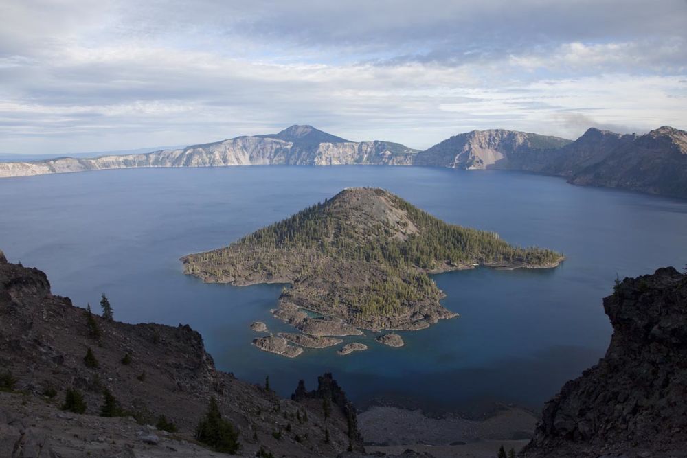
With its deepest spot 1932' below the surface, Crater Lake is the deepest lake in the United States, and the 7th deepest on the planet. It formed during a volcanic eruption some 7700 years ago that was so big that it emptied much of the magma chamber beneath. With the underlying material gone, the top of Mt. Mazama collapsed in on itself to form a caldera. Since then, there have been more eruptions, such as the one that created Wizard Island, the cinder cone near the middle of the photo.
Mt. Mazama probably reached an elevation of about 11,000 feet. It was also glaciated; glacially carved, U-shaped valleys now form part of the skyline as large U-shaped notches. We can also see just what the mountain was made of, because the walls of Crater Lake provide a dramatic three-dimensional cross-section of the volcano.
Crater Lake is one of our favorite field trip destinations at the University of Oregon. I regularly take my introductory courses there, as do many of the other faculty. And everytime I go, it's different. I shot this photo on one such field trip from the top of "The Watchman" --one of the small peaks along the caldera rim.
|
See more images of Crater Lake --then type "Crater Lake ".
See pictures of volcanic features.
Return to the "favorites" page.
Return to photography home page.
Go to the next photo, Lake Abert.