Aerial Photographs of the Basin and Range Province, California to Utah.

The Basin and Range Province is marked by alternating mountain ranges and basins. Geologically, the mountains rise and tilt along normal fault zones, while the basins drop and tilt along the faults. Individual fault-bounded blocks are typically called "tilted fault blocks". A simple cross-section across several ranges is illustrated in the diagram below.

diagram of tilted fault blocks
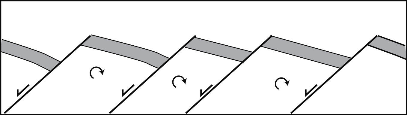
Tilted fault-block ranges, as seen in the Basin and Range Province.

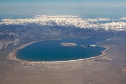
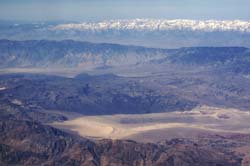
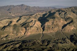
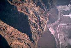
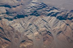
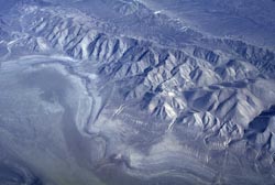
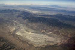
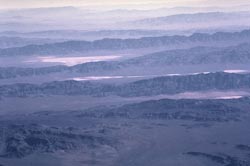
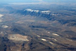
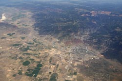
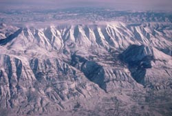
Of course, the best way to see this aspect of the landscape is from the air. Below are 12 aerial images that show parts of the Basin and Range Province, from California across Nevada to Utah, and even up to Oregon. Click on any of these photos to see or download them at higher resolutions.

Aerial view of east edge of the Sierra Nevada
Eastern edge of Sierra Nevada.
Mono Lake and east edge of Sierra Nevada
Mono Lake and east edge of Sierra Nevada.
View westward over western Basin and Range Province to the Sierra Nevada
View W over ranges to Sierra Nevada
Bare Mountain, Nevada
Wineglass Canyons, Death Valley, CA
wineglass canyon and normal fault
Wineglass Cyn and fault, Death Valley.
tilted fault block, Nevada
Tilted fault block, Bare Mtn. Nevada

Playa and tilted fault block, Nevada.
playa and ranges, eastern Nevada
Playa and parallel ranges, eastern NV.
parallel ranges of the Basin and Range, Nevada
Parallel ranges of eastern Nevada.
Steens Mountain in Oregon
Steens Mountain, southern Oregon.
Cedar City, UT and eastern edge of Basin and Range
Cedar City, UT and E edge of Basin-Range
Wasatch Mtns, Utah
Wasatch Mtns, E edge of Basin-Range.

Return to Geology and Earth Science images.

Return to home.